R&D

RESEARCH & DEVELOPMENT

Innovative, high efficiency and eco-friendly IT
through world-class engineers/researchers and aggressive investment.

  • 3D Geospatial Solution including BIM/GIS
    • Lightening 3D Modeling Data
    • Seamless Visualization of Indoor/outdoor 3D geospatial data
    • Integrated Searching Service on Facilities
    • Information on 3D Construction Elements - column, beam, slab, etc.
    • Integrated Service with Indoor/Outdoor LBS(Location Based Service), FMS(Facility Management System), BEMS(Building Energy Management System), and/or Advanced Fire Protection
    • BIM Data Conversion to 3D Geospatial Data
    • Non-plug WebGL 3D GIS
    • 3D Simulation based on Unity/3D
    As - is

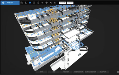
    Providing low-cost 3D Geospatial Service by - 
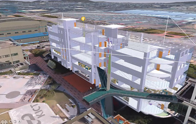
Getting indoor/outdoor 3D model easily from existing BIM/3D drawing file from construction

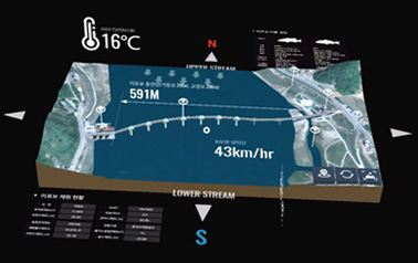
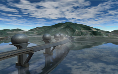
    - Integrating 3D model into 3D Geospatial Map available for Facility Management, Energy Management, Disaster Management etc. covering City, Complex Block, and Inside building

  • Integrated Solution of Disaster Management
    • Facility Maintenance by 3D Geospatial Information
    • Interface with IoT sensors for fire, flood, etc.
    • Controlling and Monitoring of CCTV and NVR
    • Supporting SOP (Standard of procedure)
    • Available on Mobile, and AR/VR Device

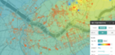
    Solution based on Big Data
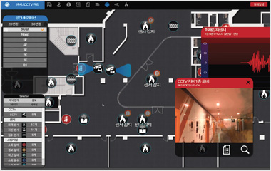
    - Managing and Monitoring against fire, flood, earthquake using BIM/GIS
    - Connecting and Collecting information from CCTV & IOT sensors

    As - is
    As - is
  • SaaS (Software as a Service)
    • Managing User Information
    • Issuing Service
    • Converting Coordinate, and Geocoding
    • Visualizing Geospatial Information
    • Publishing and Distributing Services
    • Catalog of Geospatial Information
    • Basic/General Geospatial Analysis
    • Collecting Geospatial Data using Open API
    • Providing Available Geospatial Information

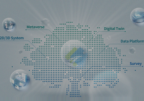
    MapPrime Cloud Service, the first GIS service as SaaS in Korea

    As - is

    Web Based Geospatial Analysis and Visualization Study on web-based spatial analysis and visualization for convenient, low-cost & easy use of geospatial data

    As - is

    Online Conversion for Geospatial Data web-based online service to convert various geospatial data format to the common for interoperability

  • Visualization Solution Based on Merged Reality(MR)
    • Virtual/Augmented Reality on Indoor/Outdoor Facility and Terrain
    • Available on Multi Devices (Mobile, Desktop, MR Device, etc.)
    • Compatible with diverse 3D model and data format

    Solution for 3D spatial visualization optimized for mobile devices - Oculus, HoloLens
    - Producing realistic 3D Contents
    - Providing virtual experience environment using VR/AR

    As - is
    As - is