-
COMPANY
-
BUSINESS
-
ESG
-
CLIENT
MapPrime is
- WebGIS Server Compliance with global standard
- Enterprise GIS SW including client version and supporting tool
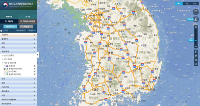
Online Cloud Service
- Producing & Sharing geospatial data whenever, wherever without SW installation on your device - PC or mobile device
- Just connect to Internet using browser
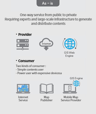
One-way service from public to private Requiring experts and large-scale infrastructure to generate and distribute contents
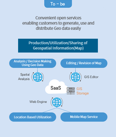
Convenient open services enabling customers to generate, use and distribute Geo data easily
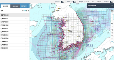
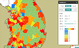
Convenient Use of Massive Public Data
Through clear classification and simple query on Massive Geo Data by reliable public organization

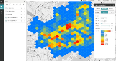
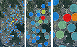
GIS Analysis and Visualization for Experts
GeoBI(Geospatial Business Intelligence) provides spatial analysis and visualization service which was available only on expensive specialized GIS SW.


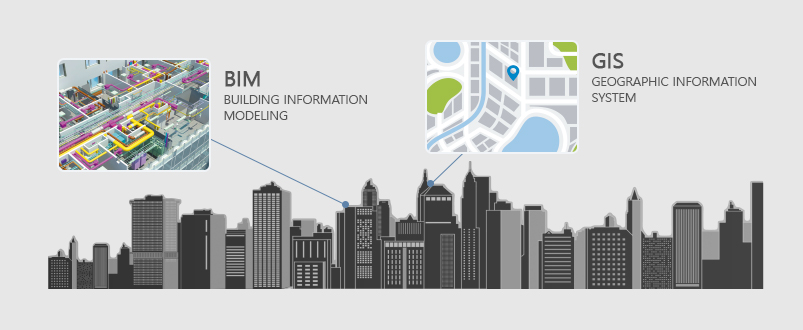
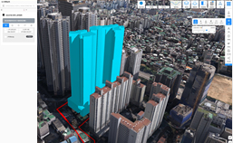
MapPrime 3D
- A total solution service interoperable with existing outdoor-based 3D GIS and indoor-based BIM.
- Having data-construction/conversion, lightweight technology, and visualization using large-capacity 3D construction spatial information.
- Containing the MapPrime 3D Web, MapPrime 3D VR, MapPrime 3D AR suite.


- Enterprise GIS solution providing server, client and utilities complying with global standard
- Sharing & editing of geospatial data, applications supporting business and client module
- Compatible with the diverse domestic or foreign DBMS