Field Survey / Database

Field Survey / Database

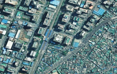
Generating high quality digital maps and aerial photographs
by Precise Nationwide Survey Providing public and/or private convergence services.
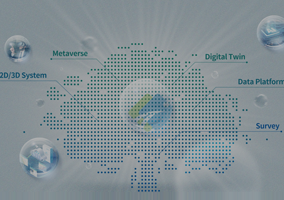
Trying new attempts according to the 4th industrial revolution.

  • Digital Twin Technology
    • Asan-si Digital Twin for River Management
    • AI Testbed with Digital Twin(LX)
    • Hongcheon-gun Digital Twin
    • Virtual Seoul 3D Spatial Information Construction
    • Samsung Display(Asan) Database Construction for Digital Twin

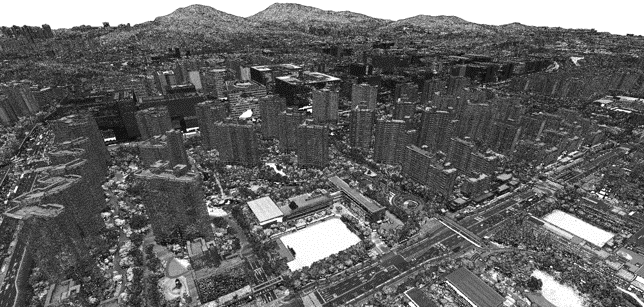
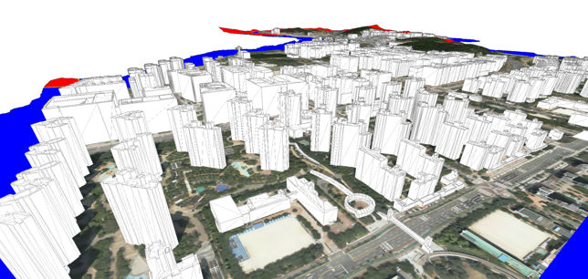
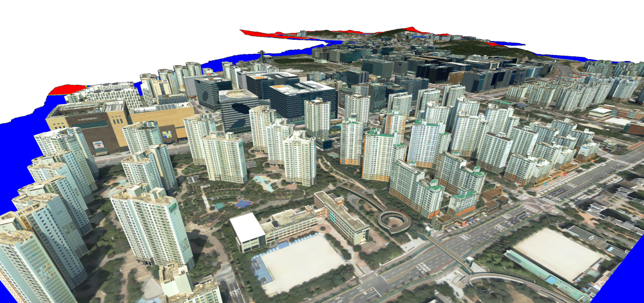
    We are building various spatial information of 3D-based digital twin environment by utilizing high-resolution data acquired by aerial LiDAR pointcloud and aerial photograph technology.

    Point Cloud Data
    Point Cloud Data
    3D Objects without Texture Mapping
    3D Objects without Texture Mapping
    3D Objects with Texture Mapping
    3D Objects with Texture Mapping
  • Construction of Forest Spatial Information
    • Creation of forest function classification plan and maintenance of forest basin map
      (Korea Forest Conservation Association)

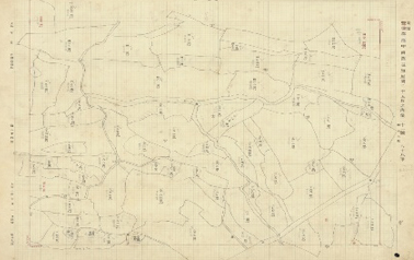
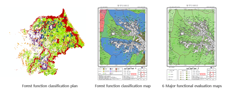
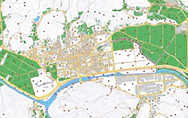
    Based on survey data and related information on forest resources, we build forest maps to support efficient forest management in the public and private sectors.

    Evaluation of 6 major forest functions
    Evaluation of 6 major forest functions
    Forest Basin Map
    Forest Basin Map

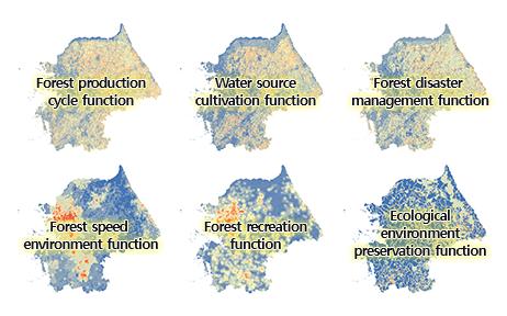
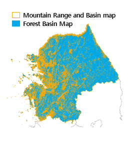
    * Evaluate the main function after assigning function points for each forest basin map

    Creation of forest function classification plan and production of drawings
    Creation of forest function classification plan and production of drawings
  • Spatial Information
    • Indoor Spatial Information
    • Rail Spatial Information for Security
    • Customized Afforestation Map
    • Forestry Map (for Korea Forestry Promotion Institute(KOFPI))

    For better Efficiency, Transparency & Fairness Building of specialized spatial data according to each organization’s need

    Indoor Spatial Information
    Indoor Spatial Information
    Customized Afforestation Map
    Customized Afforestation Map
  • Ground Survey
    • Land & Geospatial Information
    • National Interesting Point Information
    • 1:1,000 Digital Map
    • National Control Point
    • Spatial Imagery Information

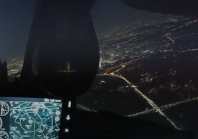
    Practical 2D/3D Map based on high-resolution aerial photos and satellite images including all existing land, resources, facilities, environmental factors, etc.

    Spatial Imaginary Information
    Spatial Imaginary Information
    Land & Geospatial Information
    Land & Geospatial Information
  • Underground Survey
    • 3D Underground Spatial Integrated Mapping
    • Underground Utility Mapping
    • MPL(Metal Pipe Locater) Survey
    • GPR(Ground Penetrating Radar) Survey
    • 3D Laser Scan Measurement

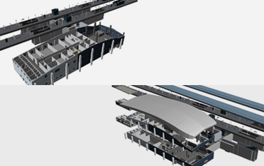
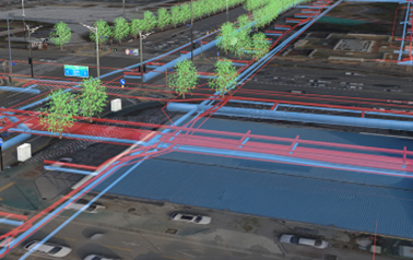
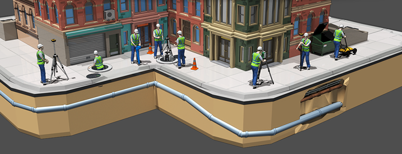
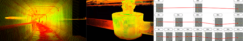
    3D Underground Spatial Map

    Building 15 kinds of underground information such as underground facility, construction, ground, etc.
    for preventing sink hole and safe development/utilizing/management of underground space at the same time

    지하측량 지하철 이미지
    지하측량 입체공간 이미지
    Underground Utility Mapping

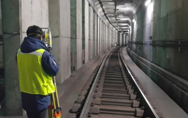
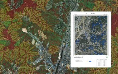
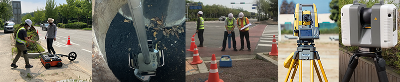
    Building database on underground utilities
    by obtaining accurate underground cable routes and by surveying roads and 7 underground facilities*.
    for preventing safety accidents

    7 Underground facilities : water-pipe, waste-pipe, gas-pipe, network-pipe, electric-pipe, heating-pipe, and oil-pipeline

  • Old Document Conservation by Digitalizing
    • Digitalization of Old Survey Document
    • Digitalization of North Korea Cadastral Original Map
    • Digitalization of Original Book/Document for Electronic Library
    • Digitalization of Old Court Sentence Document

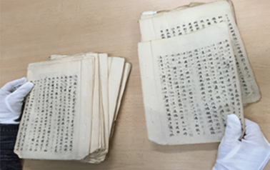
    - Digitalizing valuable historical Document
    - Utilizing digitalized data for public services

    Digitalization of Old Survey Document
    Digitalization of Old Survey Document
    Digitalization of North Korea Cadastral Original Map
    Digitalization of North Korea Cadastral Original Map