New Technology

NEW TECHNOLOGY

Leading the 4th industry revolution
through continuous technology innovations
including blockchain, self-driving, AI, etc.

  • 3D HD(High-density) Map for Autonomous Vehicle
    • National HD Map Project (NGII, Korea)
    • HD Map around Giheung & Samsung Electronics Complex Site
    • Case Study on Utilization of HD Map (NGII, Korea)

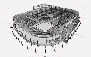
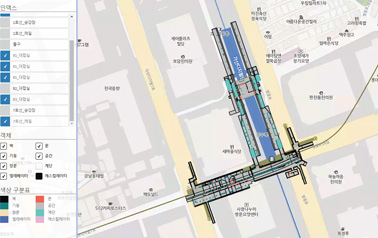
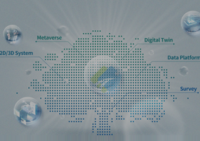
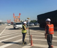
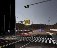
    Producing HD Road Map around 2,600 Km using the latest equipment and technology with supreme ability on MMS, mapping, and maintaining high quality.

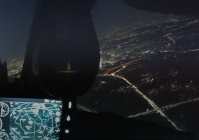
    * MMS (Mobile Mapping System) : Acquiring geographic and terrain features using GPS, Lidar, Camera and other sensors mounted on vehicles

    1
    MMS Measurement
    MMS Measurement
    2
    Control Point Survey
    Control Point Survey
    3
    Mapping
    Mapping
    4
    Quality Evaluation
    Quality Evaluation
  • Drone
    • Drone Restriction Sandbox Project
    • Development of National Land Information Monitoring System using Drone
    • Extended Operation of Ocean Road View for Harbor Limit Safety
    • Aerial Photography of UAV (Unmanned Aerial Vehicle) for Land Survey
    • Drone-based of Riverbed Fluctuations Survey and River Survey at Miho Stream, Kum River

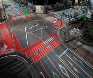
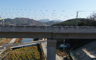
    - Drone Scanning to capture high resolution images and 3D Mapping
    - Developing technologies and solutions available to various public services such as facility safety assessment and land suitability assessment

    드론으로 찍은 다리사진
    하늘에서 드론이 찍은 사진
  • Block Chain
    • Pilot Project on Unified Real Estate Document using Block Chain Technology

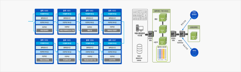
    - Study on SW using block chain technology
    - Verifying real estate transaction
    - Preventing forgery on real asset document

    블록체인 관련 이미지
  • 3D Indoor Spatial Data

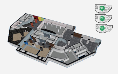
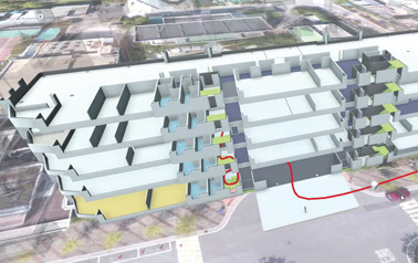
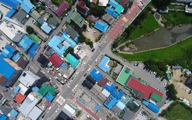
    - Building 3D indoor geospatial data
    - Utilizing 3D drawing file and LiDAR scan

    3D Spatial Data utilizing 3D drawing file and Lidar scan
    3D Spatial Data utilizing 3D drawing file and Lidar scan
    3D > 2D Auto Conversion Solution
    3D > 2D Auto Conversion Solution
    Indoor/Outdoor Seamless Guide Solution
    Indoor/Outdoor Seamless Guide Solution
    Integrating indoor spatial data with  2D/3D map
    Integrating indoor spatial data with 2D/3D map