Marine Survey / Database

Marine Survey / Database

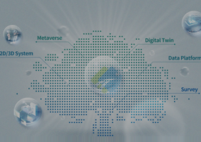
Providing services for easy use of marine spatial information
to the people for daily life,
to the officers for policy making on marine safety, fisheries, etc.

  • Precise Marine Survey
    • Precise Seabed Survey in the Eastern Seas of Jeju Island
    • Precise Hydrographic Survey at Mokpo Port/Gunsan Outer Port
    • Maritime Environment Survey for the Navy Ops. 
    • Hydrographic Survey of the Channel near Dangjin Thermal Power Plant

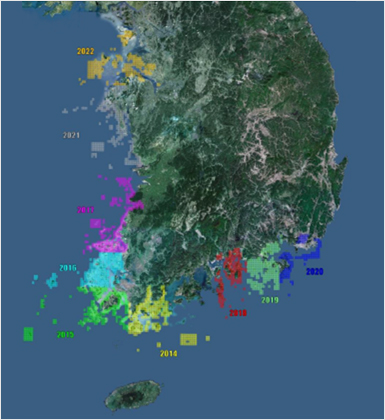
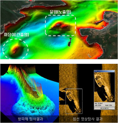
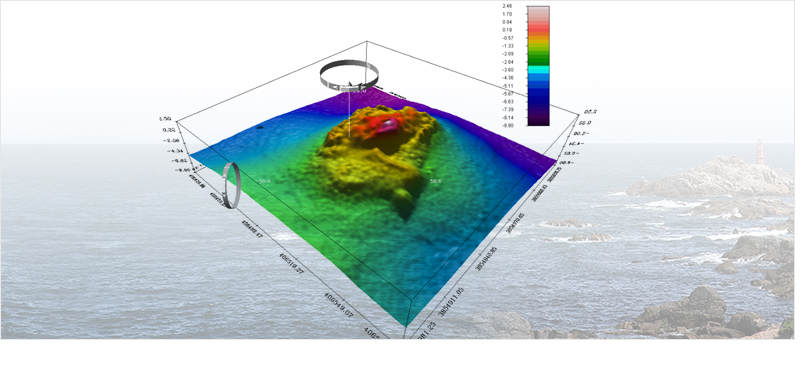
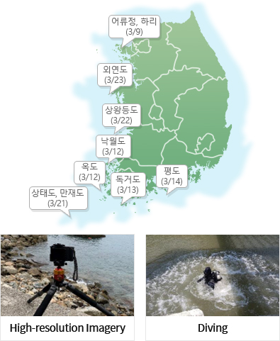
    Utilizing accumulated information from Bathymetric Survey, Multi-Beam Survey, Seabed Image, Acoustic Profiler, marine survey, artificial reef survey, etc.
    for Safe Sail, Port Construction, Military Operation, Marine Development, etc.

    한국토지정보시스템(KLIS)
    부동산종합공부시스템(KRAS)
  • Building Marine Spatial Information
    • Uninhabited Islands Survey
    • Mudflat Area Survey
    • Nautical Chart on East, West, South Coast of Korea
    • Study on the Building Database on National Bathymetric Surface Data (S-102)
    • Offshore Big Data Platform and Center Construction Project
    • Development of Marine Environment Real-time Monitoring and Forecast Simulation Technology for Autonomous Ships
    블록체인 관련 이미지
  • Marine Exploration Geophysics
    • Precise Survey of Coastal Area around Jebu Island
    • Precise Survey of Submarine Topography around West Gageo Island
    • Survey of Link Canal and Offshore Structures
    • Marine Geophysics Survey for Offshore Wind Turbine Structures
    블록체인 관련 이미지
  • Oceanographic Observation
    • Survey on Tidal Bench Mark around Southeast Coast
    • Long-Term Tidal Observation and Analysis around Kyunggi Bay
    • Costal Area Survey for Seabed Observation Station at Goseong, Kangwon

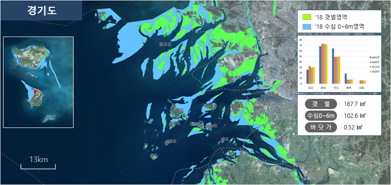
    - Collecting observed data of tide, current, wave, etc.
    - Identifying and Analizing the characteristics of costal areas
    - Providing analyzed information for marine forecast, marine design and plan

    한국토지정보시스템(KLIS)
    부동산종합공부시스템(KRAS)

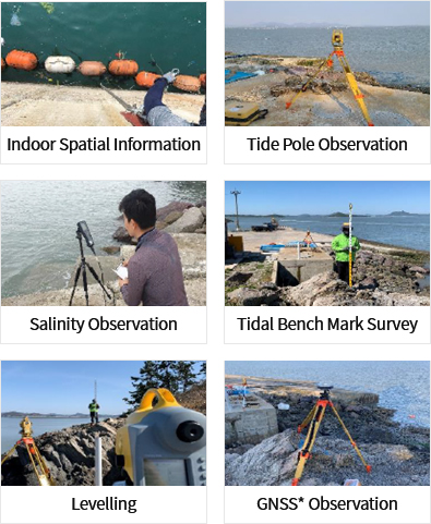
    *GNSS : Global Network Satellite System