Map Prime occupying over 70% of Korean local governments
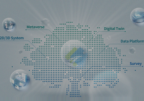
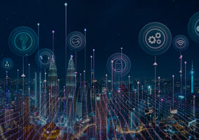
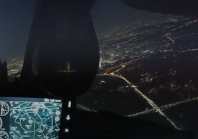
Leading Technologies of the 4th industry revolution
- Geospatial Technology of Land and Marine, Self-Driving, AI, AR/VR, etc.
Realizing cutting-edge technologies on your device.
MapPrime
Cloud
• Providing :
- Geospatial data
- Editing tools for GIS data
- Design tools for GIS service
• Lowering geospatial service cost
• Enabling convenient share, utilization and open of geospatial contents regardless provider and consumer
MapPrime
3D
Converging geospatial data of land & building with administrative information of real estate and urban planning based on GIS/BIM
• Increasing work efficiency
• Supporting the decision-making process
MapPrime
GIS Web Server®
• Certified by OGC, international standard
• Visualizing, sharing and editing geospatial data
• Selected by 70% of Korean local governments
• Providing the best service through customization according to the market changes and customer needs
MapPrime
GIS Server®
• Providing
- Seamless data sharing in various forms of spatial data
- Powerful spatial computation capability
• Used for the civil service to issue official documents of real estate
• Ensuring stabilized performance for data processing(search/update/compute)
MapPrime
Desktop®
• MapPrime's PC version to visualize and to edit spatial information supporting both DBMS and file.
MapPrime
Web Tile Maker®
• Tool to generate tiles with styles for internet-based map service.
MapPrime
SDK®
• OLE/COM development kit that helps the development of various Windows applications using C++,C#,VB etc.