Before
After
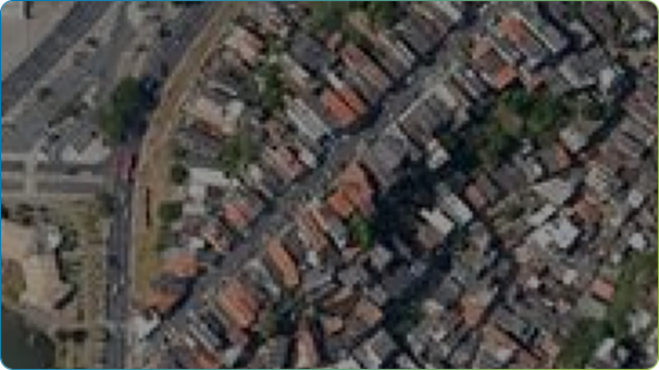
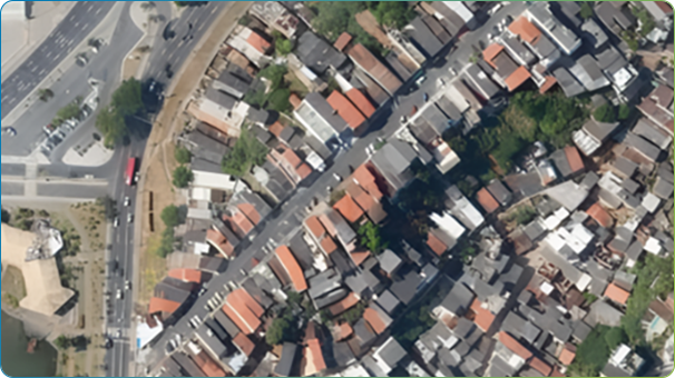
GeoAI_Resolution Enhancement
We use artificial intelligence to enhance low-resolution images, such as satellite imagery
or historical aerial images, that are difficult to interpret or analyze, transforming them
into high-resolution images.
We possess AI models that can improve existing images by 2x to 4x in resolution.
We possess AI models that can improve existing images by 2x to 4x in resolution.
2023
2024
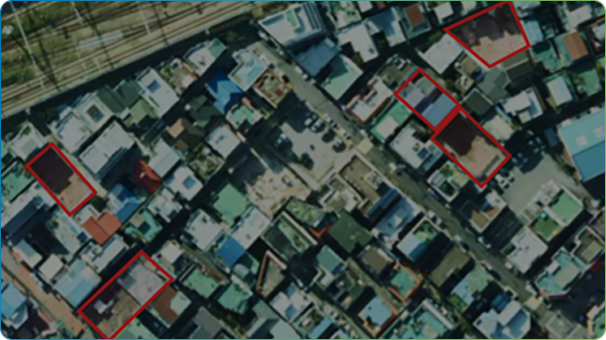
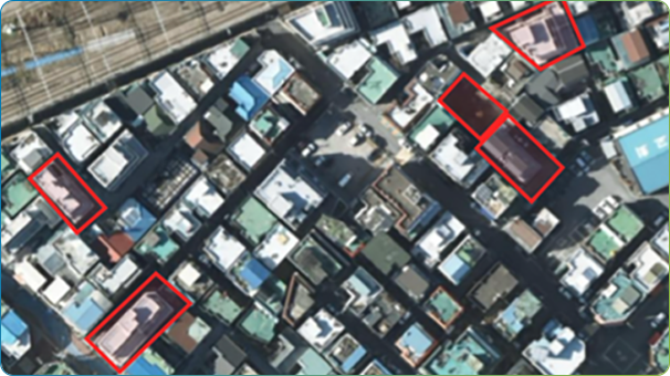
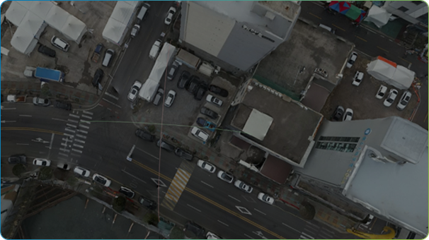
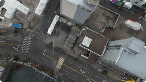
GeoAI_Change Detection
National and local governments often compare past and present images
visually for tasks such as urban planning, revenue generation, and illegal
construction monitoring. This process is time-consuming and costly.
To address this, we have AI models capable of instantly detecting areas of change between past and present images.
To address this, we have AI models capable of instantly detecting areas of change between past and present images.
Before
After
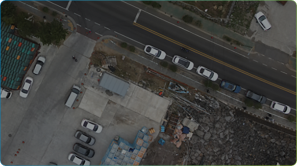
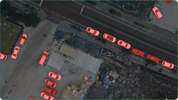
GeoAI_Object Detection
In many fields such as administration, transportation, and geospatial information,
workers manually create numerical maps or thematic maps from aerial or drone images.
We possess AI models that can automatically extract such data.
The automatic extraction targets include buildings, vehicles, people, streetlights, clouds, and more, with plans for continuous expansion.
We possess AI models that can automatically extract such data.
The automatic extraction targets include buildings, vehicles, people, streetlights, clouds, and more, with plans for continuous expansion.
Before
After
GeoAI_Object Removal
When constructing realistic imagery or digital twins, unnecessary information
is often included, such as vehicles or street trees, which are not needed for
high-quality information construction. We possess AI models that can instantly
remove such unnecessary information from images.
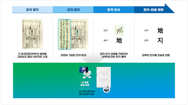
OCR AI
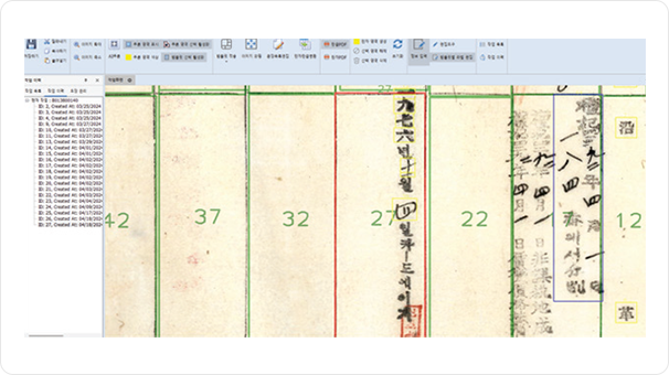
Hangulization Operation Screen_Main Screen
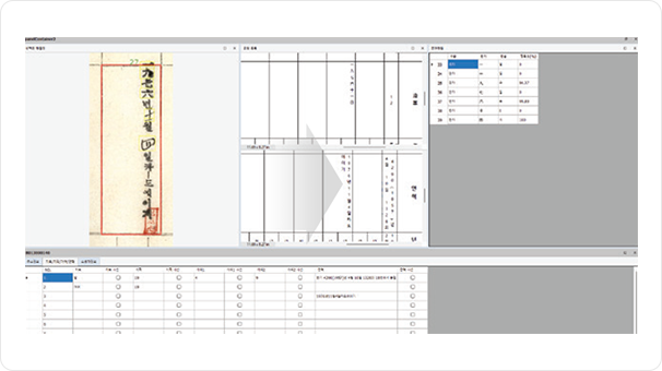
Hangulization Operation Screen_Sub Screen
MapPrime OCR AI
- AI-based detection of Hanzi (Chinese characters) areas in old land registry documents
- Supports natural language processing for detected Hanzi areas in both Chinese characters and Hangul
- Continuous performance improvement through automatic re-learning
- Application of AI-based Hangul digital conversion for old land (forest) registry documents
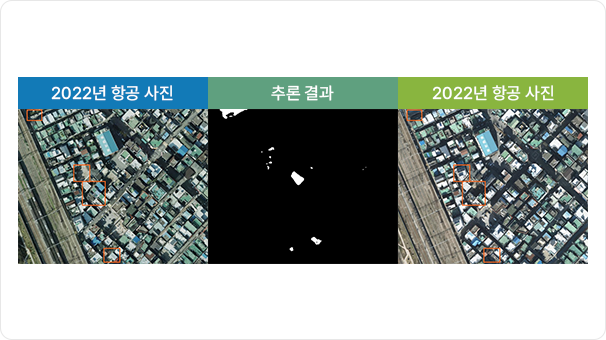
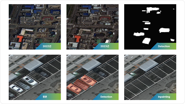
Segmentation AI (Change Detection)
Inpainting AI
Before
After
SuperResolution AI
Original
Super Resolution
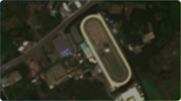
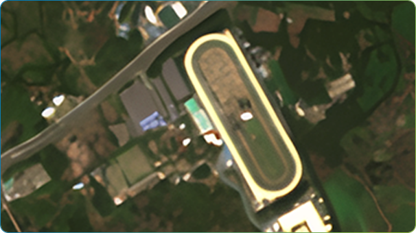
MapPrime Geo-AI Processing
- Segmentation AI: An AI that detects objects such as buildings, change detection, vehicles, people, streetlights, clouds, light reflections, fish farms, and marine debris in aerial images (including drone photos).
- Inpainting AI: An AI that erases user-defined areas from the results of Segmentation AI inference or from images.
- SuperResolution AI: An AI that performs super-resolution on images of aerial photos, drone images, and digital twin objects to enhance their resolution.
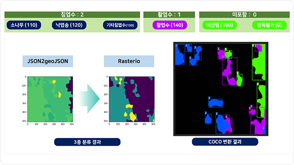
AI-based Forest Object Extraction
By learning from various geospatial data and satellite big data databases, we use AI to detect forest objects.
AI-based Crop Type Detection
AI-based Crop Yield Prediction
An AI trained on orthophotos automatically detects crop types
and predicts crop yields based on geospatial information.
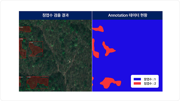
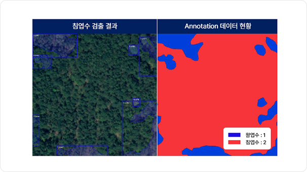
The AI trained on forests automatically detects forest species and environmental changes to calculate carbon sequestration.
The AI trained on forests automatically detects forest species and environmental changes to calculate carbon sequestration.
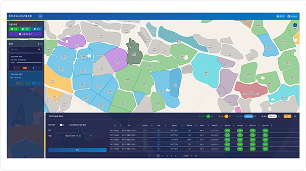
AI-based Geospatial Information
Construction and Editing
We detect models such as buildings, vehicles, and people in aerial
and drone imagery and monitor changes in individual models.
We build GIS databases and use them as foundational data for digital twins across various fields.
We build GIS databases and use them as foundational data for digital twins across various fields.