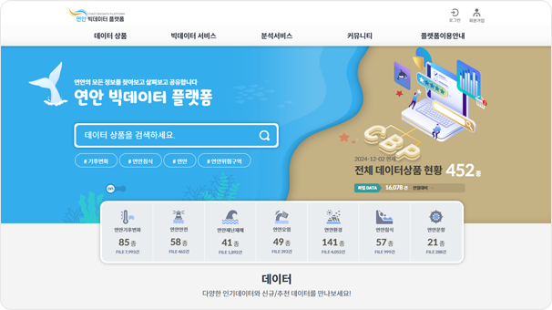
Coastal Big Data Platform
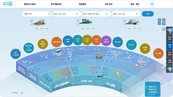
R&D Knowledge Information System (BADABOM)
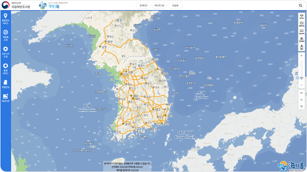
Marine Spatial Information Service for The Public (Gaebang-Hae)
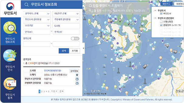
Uninhabited Island Information Inquiry
Maritime Information Service
We provide a national maritime spatial information portal service that
collects and provides information necessary for maritime activities
such as safety, fisheries, and leisure/tourism, making maritime
spatial information easily and conveniently accessible.
Marine and Fisheries Big Data Platform
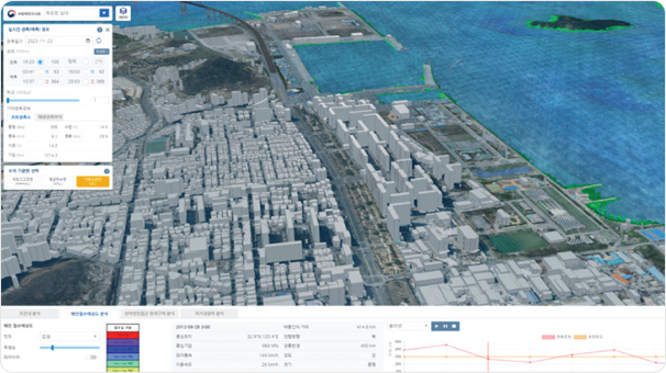
Marine Digital Twin Production
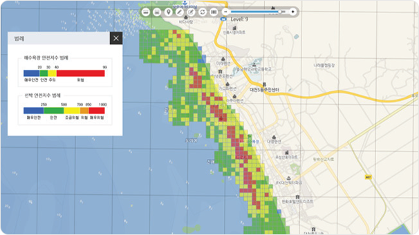
Beach Safety Index
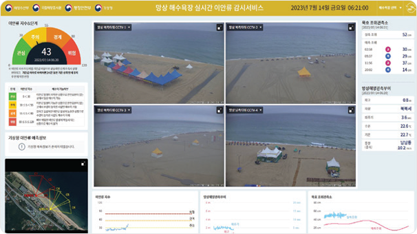
Real-time Offshore Current Monitoring
Marine Spatial Decision
Support System
We collect marine spatial information, such as marine fisheries data
analysis, marine spatial planning support, uninhabited island information
systems, and rip current monitoring systems, to provide the necessary
information for decision-making.
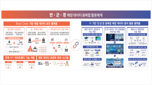
Development of a Military-Civilian-Police Marine Data Security Platform and Analysis/Utilization Technology
We are building a secure platform to support the sharing and
utilization of marine data between the Ministry of Oceans and
Fisheries, the Navy, and the Coast Guard, while developing
AI-based analysis and utilization technologies.
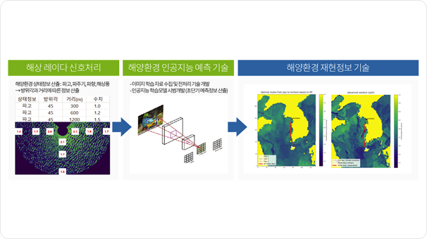
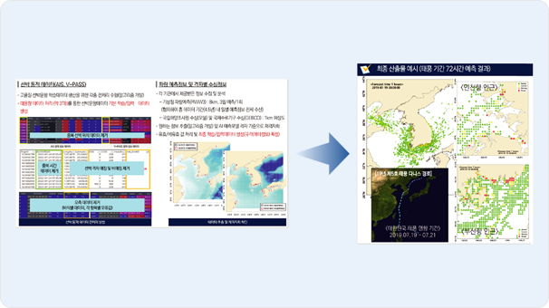
Development of Marine Environment Information Reliability Verification Technology for Autonomous Ships
We are developing high-resolution grid-based marine environment
prediction data (4 types of marine environment, 4 types of waves,
and 4 types of marine weather) for autonomous and eco-friendly vessels.
This data will be visualized and made reproducible through a platform.
This data will be visualized and made reproducible through a platform.
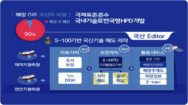
Development of Core Technology
for National Marine GIS Based on
S-100 Standard
We aim to localize core national GIS technologies (such as seabed topography
data processing, base map creation, and chart production), which have previously relied on foreign solutions, to contribute to the development
and utilization of the marine industry and lead international standards.
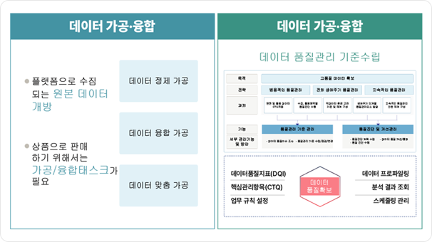
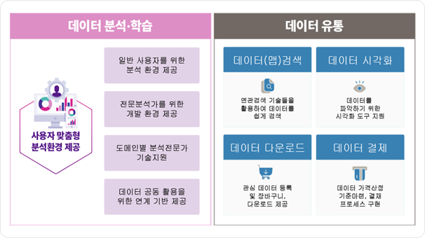
Development of Big Data
Platform and Center
for Coastal Areas
We support the establishment of a self-sustaining big data platform and
network to activate the accumulation and distribution of data related to
coastal areas, while creating a foundation for the distribution and transaction of data.
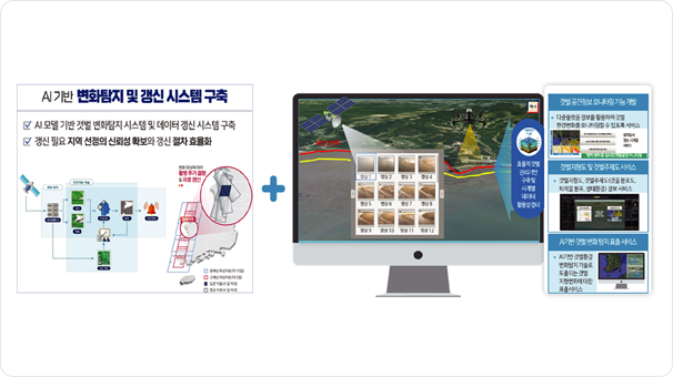
Development of Tidal Flat Spatial
Information Change Monitoring
Technology
Improving the limitations of tidal flat topography observation methods,
and through systematization/standardization of spatial information for
each change type, generating thematic maps and establishing an
integrated tidal flat spatial information management system.
Development of GIS-based
Traffic Congestion Prediction
Model Using Vessel Operation
Data
Developing high-resolution grid-based marine environment prediction
information (4 types of marine environment, 4 types of waves, 4 types
of marine weather) for autonomous and eco-friendly ships, and visualizing
this data to reproduce it through a platform.