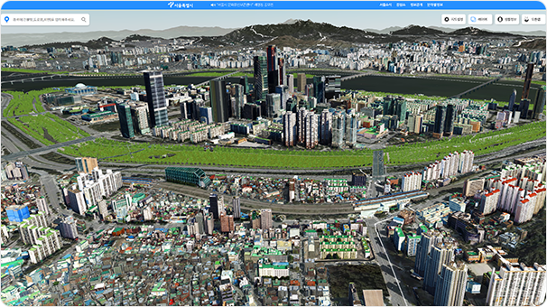
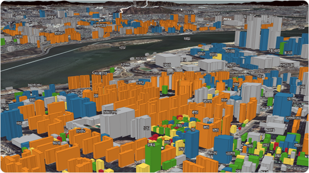
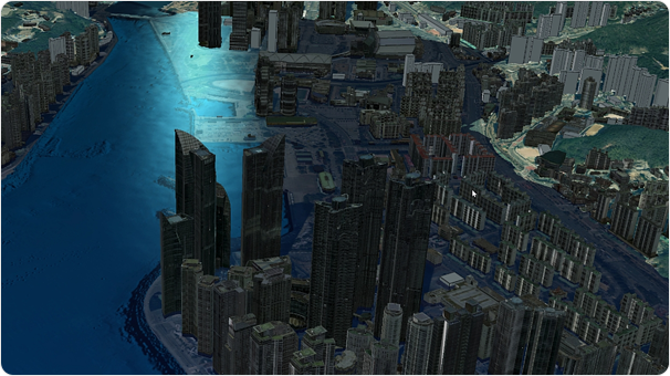
MapPrime 3D City Urban Planning & Management
We provide decision-support tools specialized in various fields such as land use, environment,
and landscape for the development, regeneration, and preservation of cities.
Through 3D-based query and analysis functions, we visually represent administrative information in a three-dimensional way, maximizing the efficiency of urban operations.
Through 3D-based query and analysis functions, we visually represent administrative information in a three-dimensional way, maximizing the efficiency of urban operations.
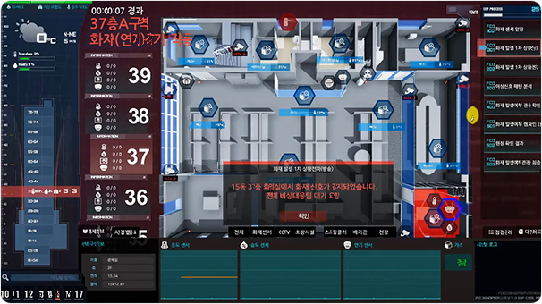
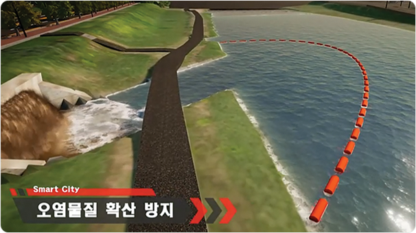
MapPrime 3D City Disaster and Safety Management
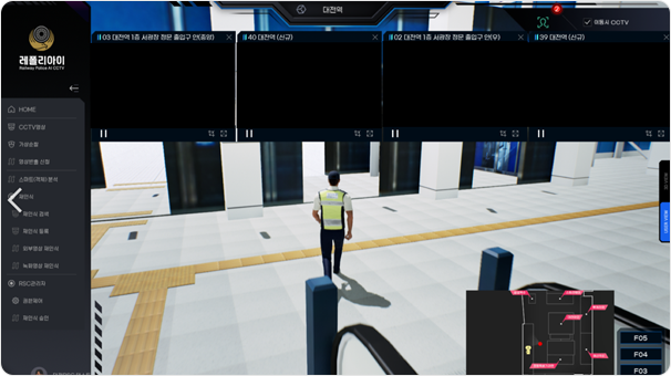
We provide safety management services at both regional and building levels by integrating
various IoT sensors and spatial information, enabling rapid response to disaster situations
such as fires and collapses in urban areas, and minimizing disaster damage.
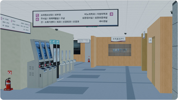
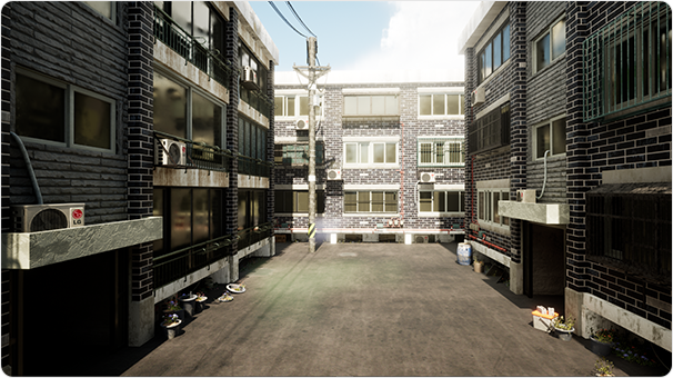
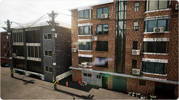
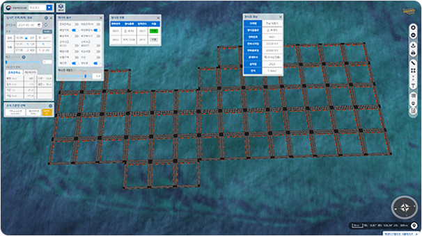
MapPrime 3D City Indoor Spatial Information & Facility Management
We provide decision-support tools specialized in various fields such as land use, environment,
and landscape for the development, regeneration, and preservation of cities.
Through 3D-based query and analysis functions, we visually represent administrative information in a three-dimensional way, maximizing the efficiency of urban operations.
Through 3D-based query and analysis functions, we visually represent administrative information in a three-dimensional way, maximizing the efficiency of urban operations.
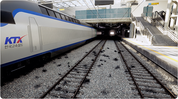
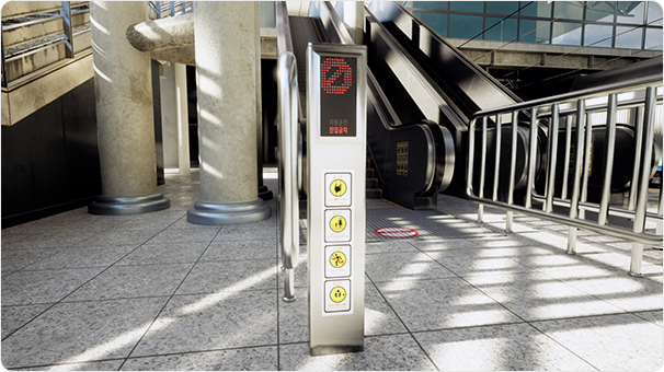
MapPrime 3D City Immersive Content
We provide various immersive content, including detailed 3D models and realistic simulation
features, to accurately replicate real-world spaces in the virtual world.
By combining high-quality spatial information with visualization technologies suitable for specific purposes, we lead the way in realizing a digital twin of the nation.
By combining high-quality spatial information with visualization technologies suitable for specific purposes, we lead the way in realizing a digital twin of the nation.
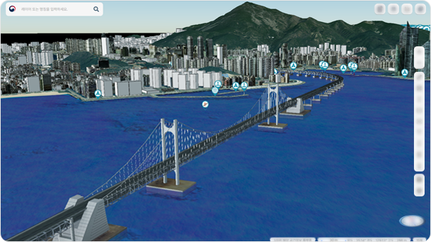
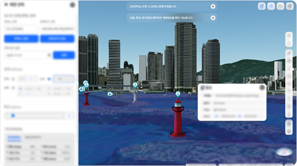
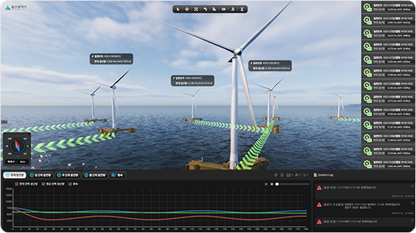
MapPrime 3D Ocean Marine Digital Twin
By applying extended reality technologies such as virtual reality, augmented reality, and mixed reality
to marine spaces, we provide immersive metaverse services that transcend physical limitations.
We create a 3D simulation environment that utilizes marine environmental and physical factors, enabling simulation and prediction to support marine safety accident prevention and decision-making.
We create a 3D simulation environment that utilizes marine environmental and physical factors, enabling simulation and prediction to support marine safety accident prevention and decision-making.
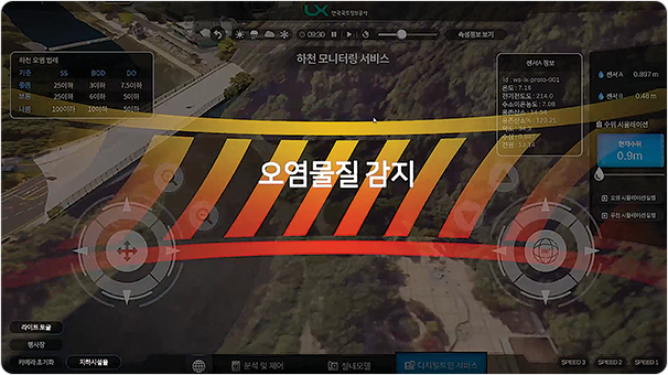
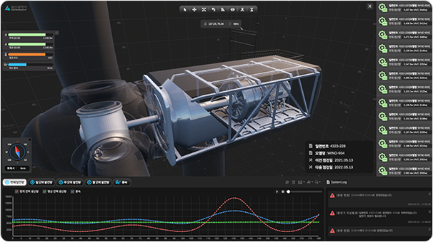
MapPrime 3D Ocean Marine Monitoring
We provide systematic monitoring services by visualizing real-time marine data,
such as depth and water quality, collected through IoT sensors in a 3D space.
By combining the intuitiveness of spatial information with the real-time capabilities of IoT sensors, we establish a tailored management system.
By combining the intuitiveness of spatial information with the real-time capabilities of IoT sensors, we establish a tailored management system.
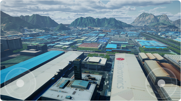
MapPrime 3D Industry Smart Plant
We provide management services that integrate the complex structures of plant sites with
IoT sensors and field worker information, enabling proactive response to emergency situations.
This transforms the previous independent management systems for plant equipment and safety management into an organic, interconnected system.
This transforms the previous independent management systems for plant equipment and safety management into an organic, interconnected system.
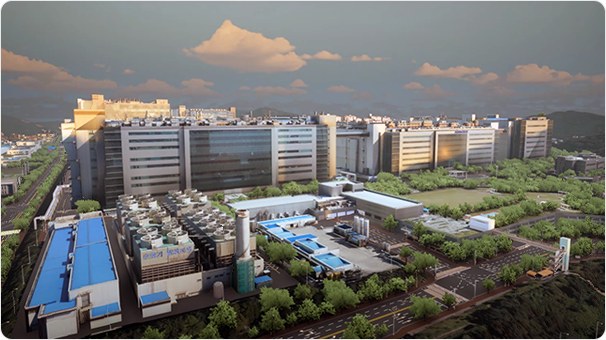
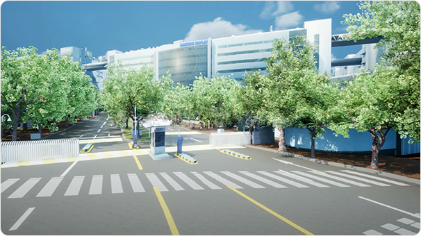
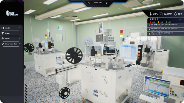
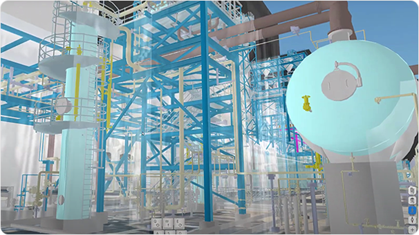
MapPrime 3D Industry Smart Factory
We provide process management services by collecting real-time process data and events
occurring inside and outside the factory, analyzing and diagnosing process conditions.
Through operational support across the entire lifecycle—from design, production, and operation to maintenance—we enhance quality and productivity.
Through operational support across the entire lifecycle—from design, production, and operation to maintenance—we enhance quality and productivity.
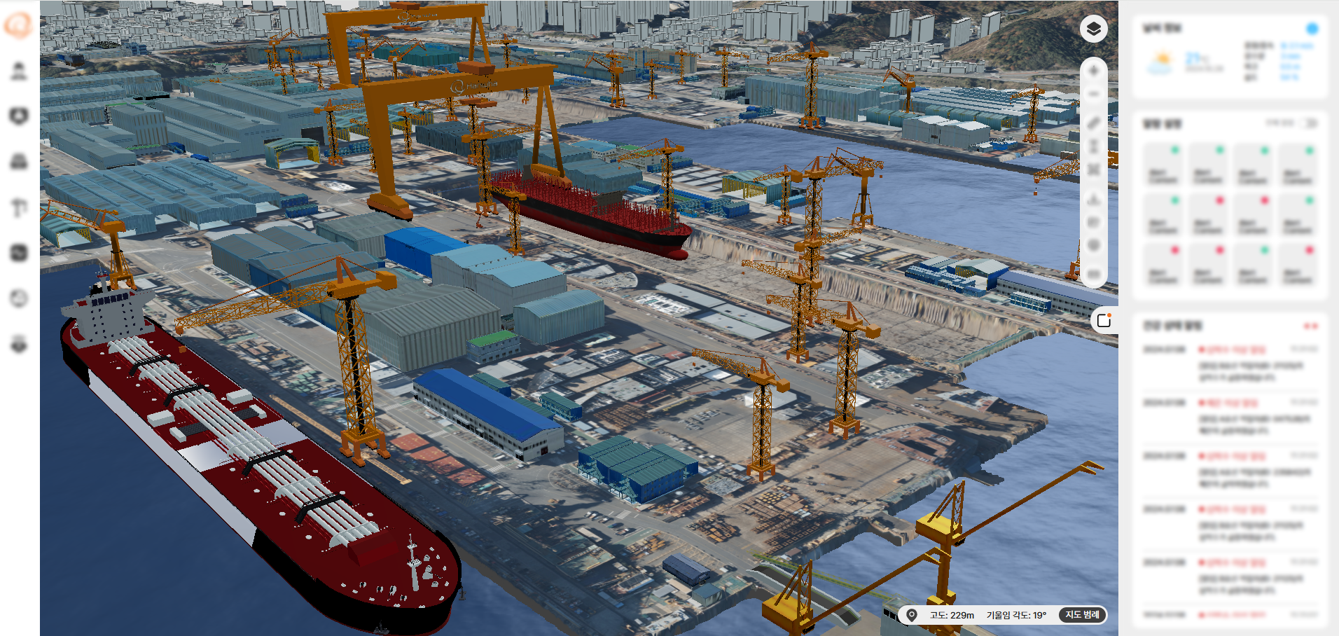
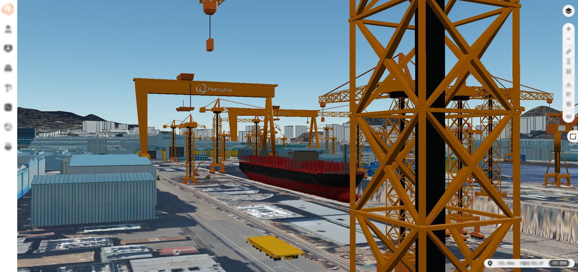
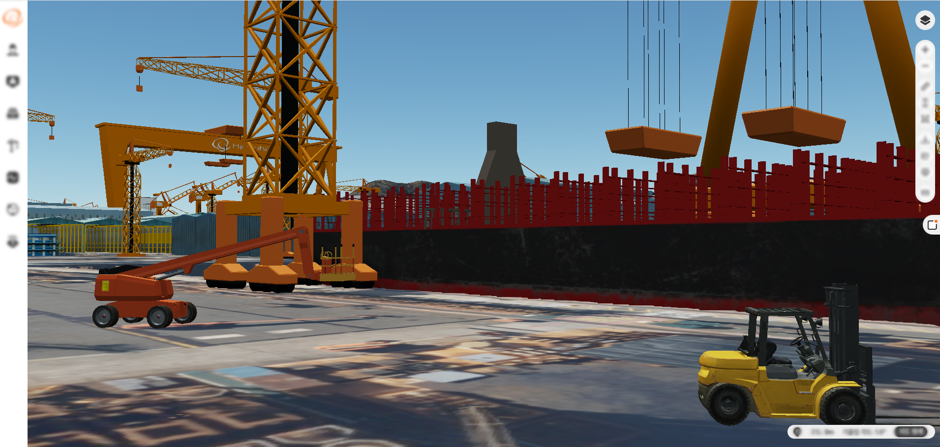
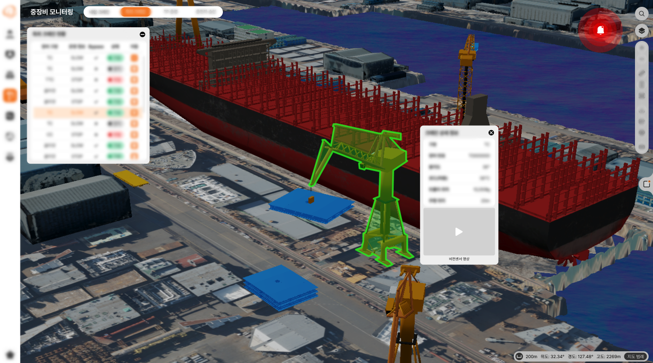
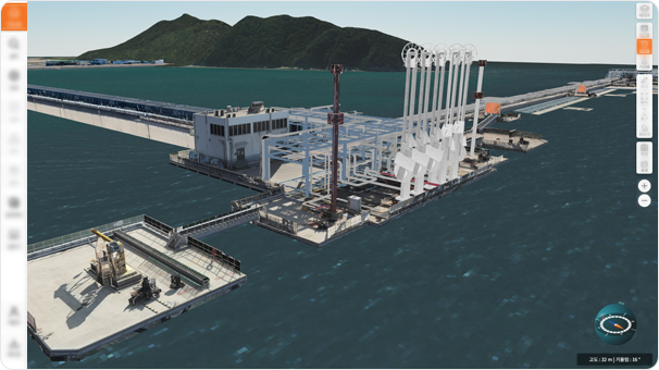
MapPrime 3D Industry Smart Shipyard
A comprehensive solution based on 3D digital map is implemented using MapPrime 3D for integrated control and monitoring to maximize operational efficiency.
To achieve this, various systems at the shipyard—such as CCTV, worker management, cranes, heavy machinery, gas detection, vessel IoT, and vehicle tracking—are seamlessly connected through the 3D digital map.
To achieve this, various systems at the shipyard—such as CCTV, worker management, cranes, heavy machinery, gas detection, vessel IoT, and vehicle tracking—are seamlessly connected through the 3D digital map.
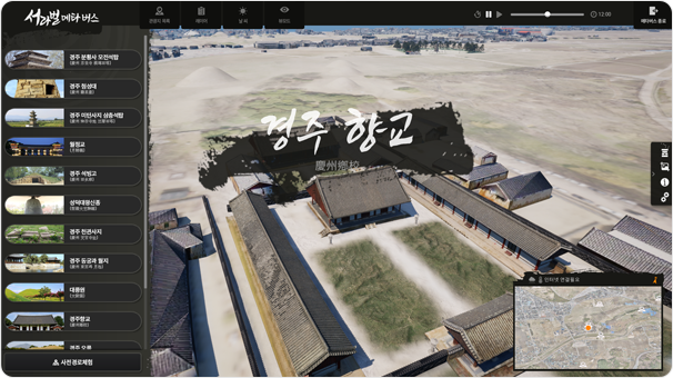
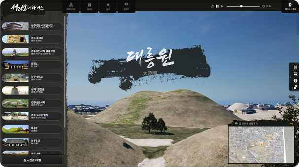
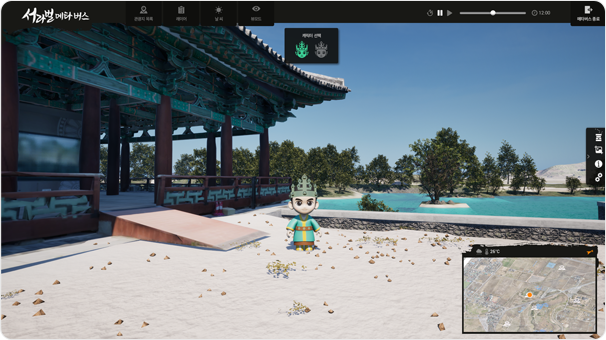
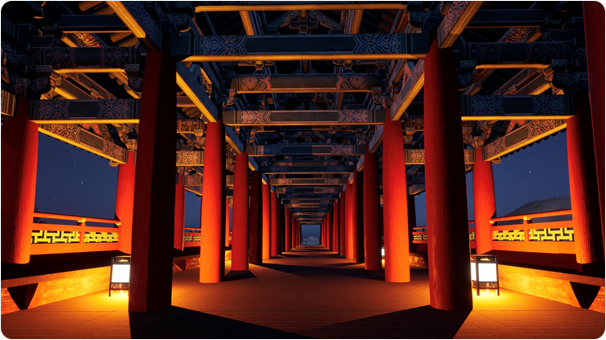
MapPrime 3D Culture Metaverse
We provide tourism content services that allow users to travel through virtual spaces such
as cultural heritage sites, accommodations, and shops, while also interacting with others.
Through the metaverse, we create a vibrant digital cultural ecosystem where people can enjoy culture without the constraints of time and space.
Through the metaverse, we create a vibrant digital cultural ecosystem where people can enjoy culture without the constraints of time and space.

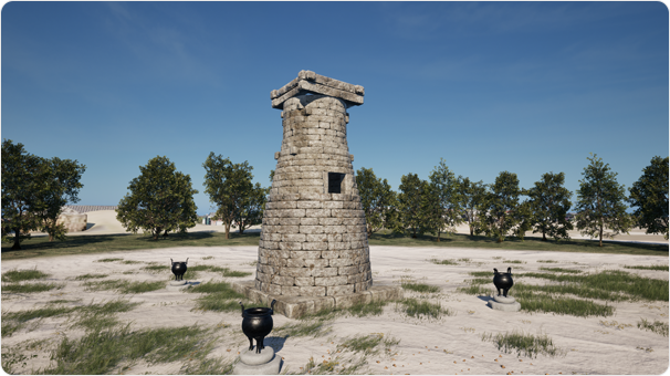
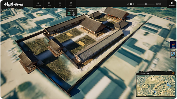
MapPrime 3D Culture Cultural Heritage
We support the preservation, management, and utilization of cultural heritage by reproducing
and restoring existing cultural assets, as well as those that have been lost or are inaccessible.
Through the preservation and transmission of cultural heritage based on digital twins, we create future value and contribute to the sustainable development of culture.
Through the preservation and transmission of cultural heritage based on digital twins, we create future value and contribute to the sustainable development of culture.