MapPrime
MapPrime, a solution that covers all stages from data production to service delivery,
is the best choice in the era of digital twins and AI.


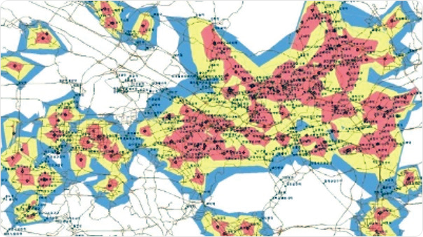
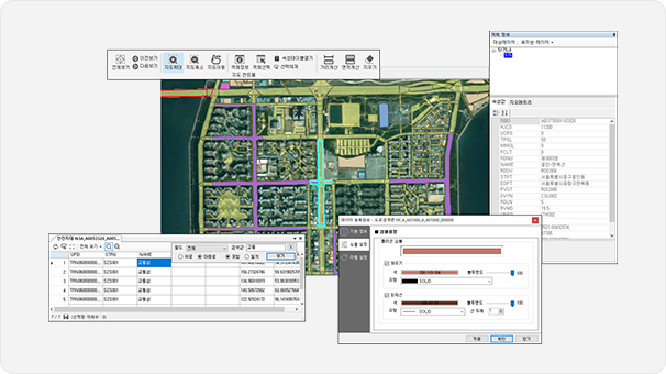
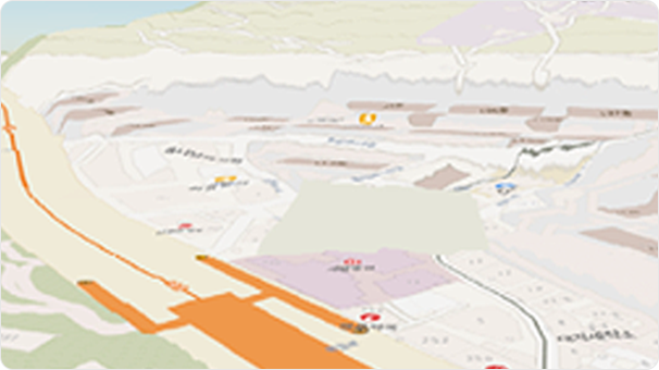
National General Hospital Arrival Time Analysis
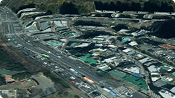
Flood Trace Visualization
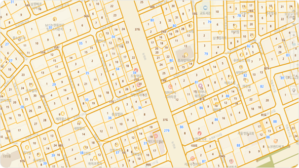
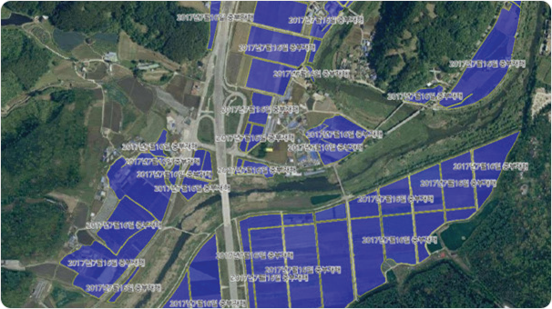
Cadastral Map/Continuous Map Generation and Management
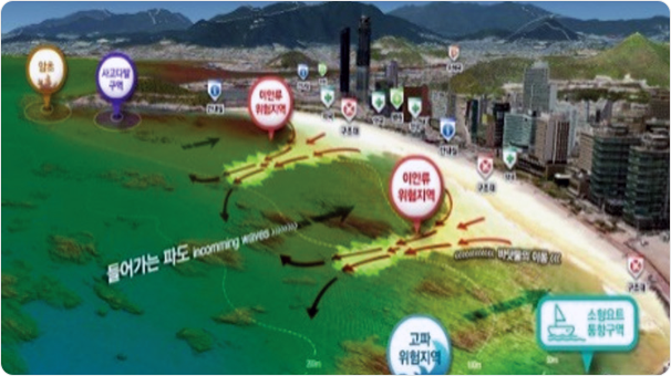
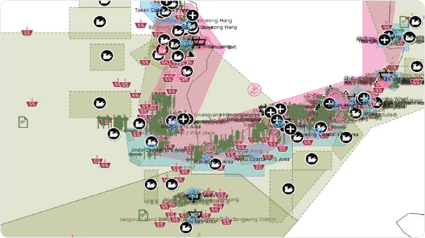
Beach Safety Map
Mapprime v2.0 _ MapPrime GIS Web Server
- Geospatial Information Conversion Service Engine (JPG, PNG Images, XML, JSON Text)
- Support for Various OS Platforms (UNIX, Windows, Linux)
- OGC International Standard Server, UI-Based Style Generation, and Tile Generation Tools
Mapprime v2.0 _ MapPrime GIS Server & Desktop
- GIS Data Management and Analysis Processing GIS Server with Integration of Various DBMS
- User-Friendly UI-Based Desktop Component (OCX) Developed with MapPrime SDK
- Development API Provided
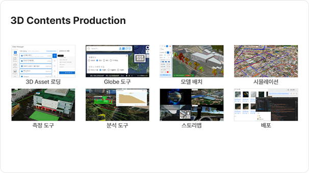
Aerial Photography
Topographic Map
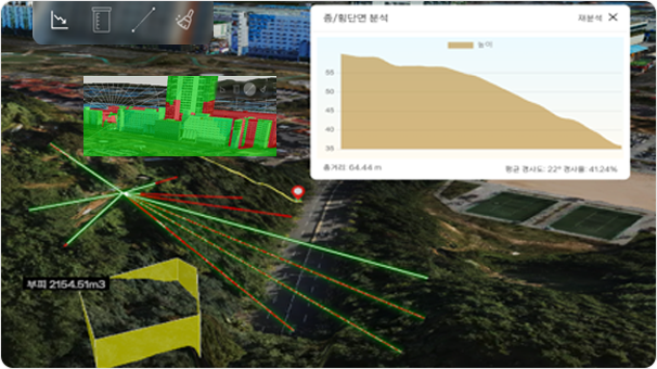
Measurement and Analysis
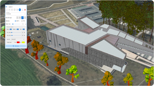
3D Model Placement
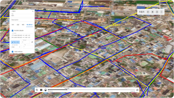
Simulation

Story Map

S-101 Electronic Navigational Charts (ENC) Product

S-102 Bathymetric Surface Product
S-127 Marine Traffic Product
MapPrime ENC
- IHO Universal Hydrographic Standard Data Management Service
- S-101 Electronic Navigational Charts (ENC) Product Editing Functionality
- Support for Management of Marine Standard Geospatial Data, including Points, Multipoints, Curves, and Surfaces
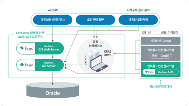

MapPrime for KRAS v1.0
- Transition from Foreign GIS Solutions to Domestic MapPrime Solution
- Compliance with Spatial Information Software Quality and Performance Evaluation for the Promotion and Support of the Domestic Software Industry
- Application of Real Estate Comprehensive Study System to Over 160 Local Governments Nationwide
- Application of Spatial Information Utilization Features to Cadastral Management, Zoning and Districts, Survey Results, and Spatial Data Aggregation Systems
3D Builder
3D Manager
3D Studio
MapPrime 3D GIS
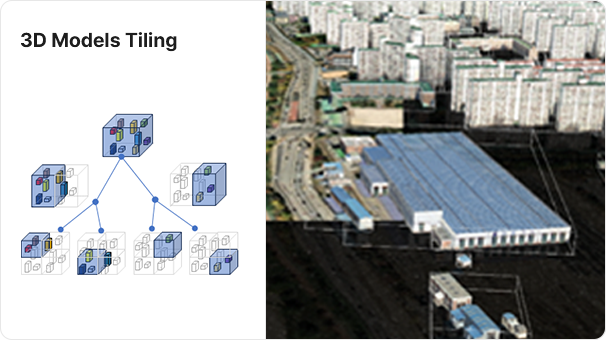
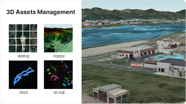
- Seamless Indoor/Outdoor Geospatial Information Integration and Visualization Based on Web and Game Engines
- Tiling and Lightweighting of Large-Scale Assets (Construction Data (BIM), 3D Models, Terrain, Orthophotos)
- 3D Digital Twin Content Creation, Distribution, and Sharing Service
- 3D-Based Analysis and Simulation Functionality


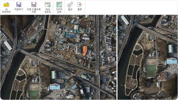
MapPrime DSM Recon
- Solution for Automatically Generating 3D Models Using Sequential Images
- High-Quality Implementation with Minimal Photos Using DepthMap AI
- Features for Easily Modifying/Deleting/Replacing Generated 3D Mesh
- Digital Surface Model Reconstruction
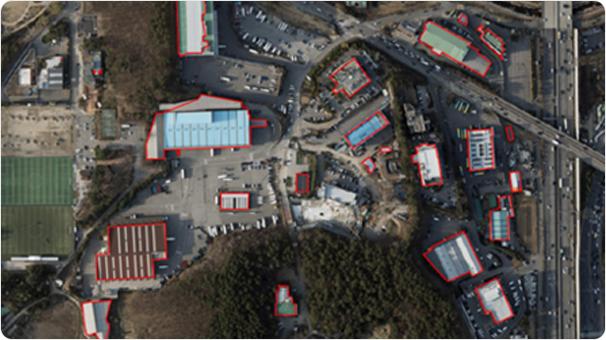
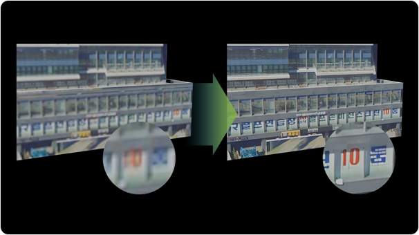
MapPrime Solid Recon
- Solution for Automatically Creating Digital Twin Worlds Using Sequential Aerial Photos (Including Drones)
- Incorporation of Epipolar Geometry Algorithm
- AI-Based Replacement of Manual Processes for Building Extraction and Texture Editing, Reducing Excessive Manual Effort
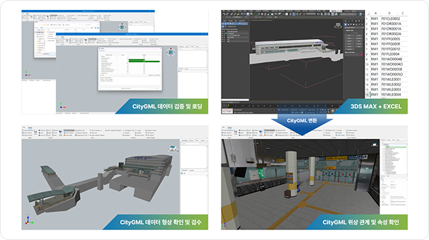
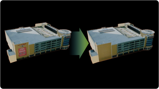
MapPrime CityGML
- Logical Structure and Attribute Information Validation of CityGML Construction Results
- Support for Converting Building and Underground Facility Models Built on 3DS MAX to CityGML
- Support for Converting CityGML Data to Standard Data Models such as OBJ and 3DS
- Support for Converting CityGML-Based Urban Models to 3D Service Tile Sets
The released version only supports the CityGML 2.0 model view and attribute information verification functionality.