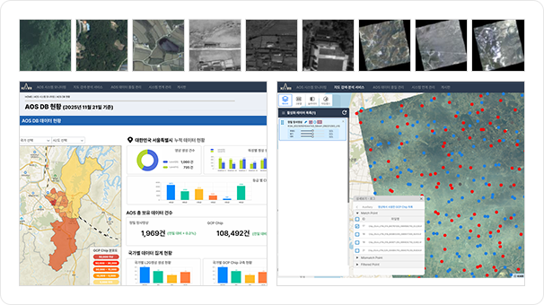
Automatic Construction of GCP Chip and DEM Verification
Ariang Satellite GCP Chip/DEM Verification
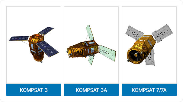
High-precision orthoimages and GCP chips are produced automatically from satellite imagery
acquired from KOMPSAT-3, 3A, and 7. Web systems manages the produced orthoimages
and GCP chips.
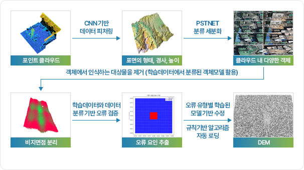
Advanced DEM Refinement using Deep Learning Technology
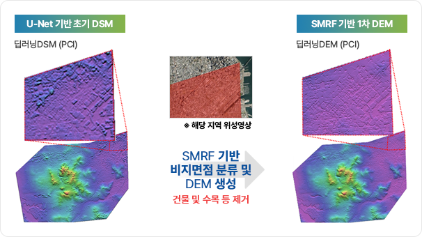
SMRF-based Non-ground points Removal
Ariang Satellite Advanced DEM Refinement
AI deep learning-based DEM refinement technology automates noise removal and occluded area interpolation during DEM generation from point cloud datafr om satellite data
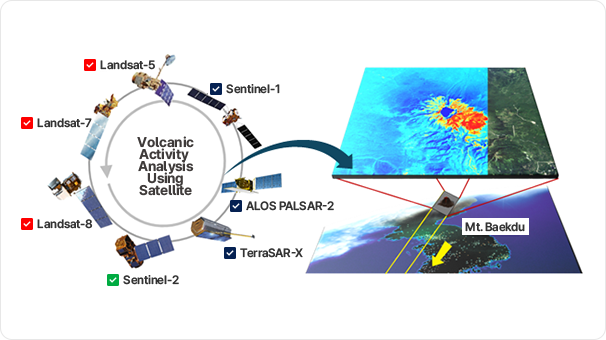
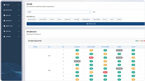
K-VOMS Volcanic Monitoring
K-VOMS is an integrated web-based monitoring system that processes the entire workflow
from monitoring to analyzing and reporting of volcanic activity using satellite imagery.
from monitoring to analyzing and reporting of volcanic activity using satellite imagery.
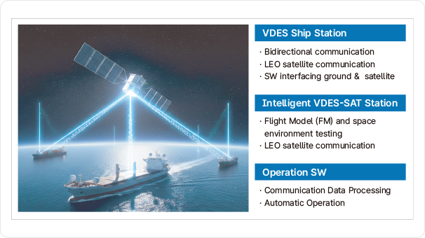
VDES Satellite
We develop the integrated maritime communication using microsatellite to overcome coastal coverage limitations through satellite-to-vessel VDES communication.