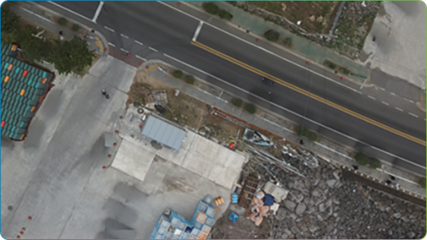
Before
After
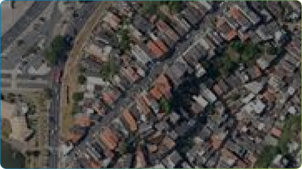
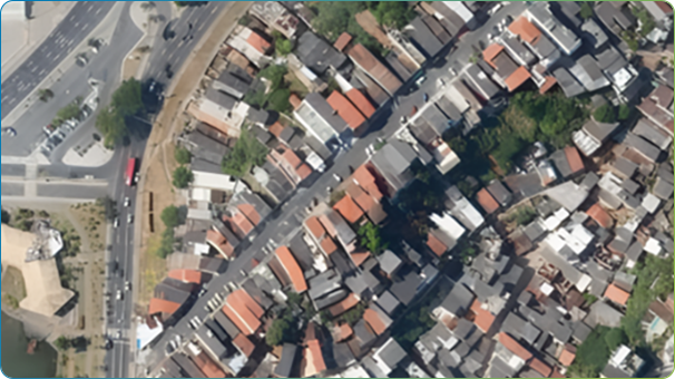
Geo_AI Enhancing Spatial Resolution
Our AI-powered resolution enhancement technology increases image clarity by 200% to 400%. This enables efficient object detection and data analysis, even when working with low-resolution satellite data or legacy aerial archives
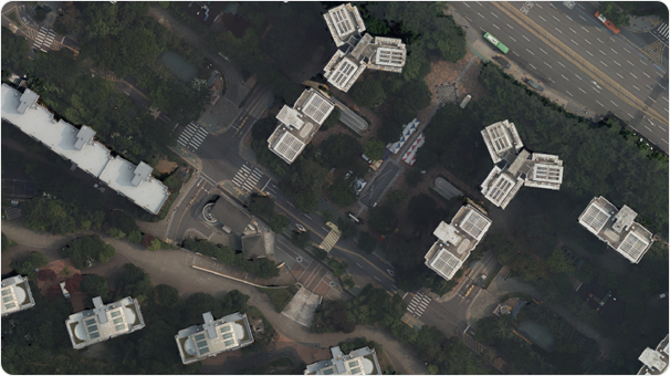
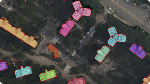
2023
2024
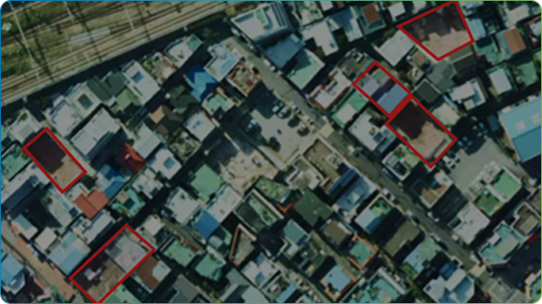
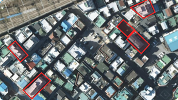
Geo_AI Change Detection
Geo-AI Change Detection automatically detects spatial changes in time-series data. Our solution significantly reduce the time and cost to identify illegal building while maximizing efficiency
Before
After
Before
After
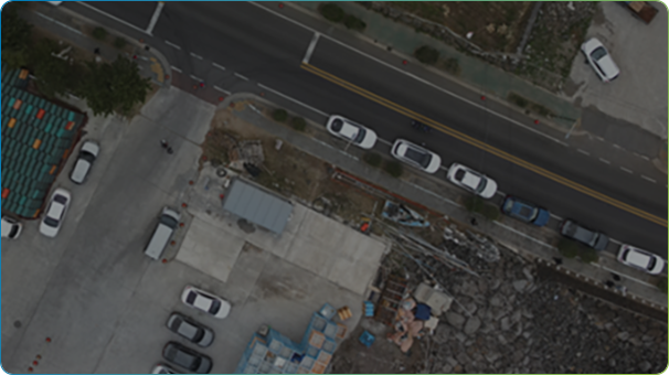
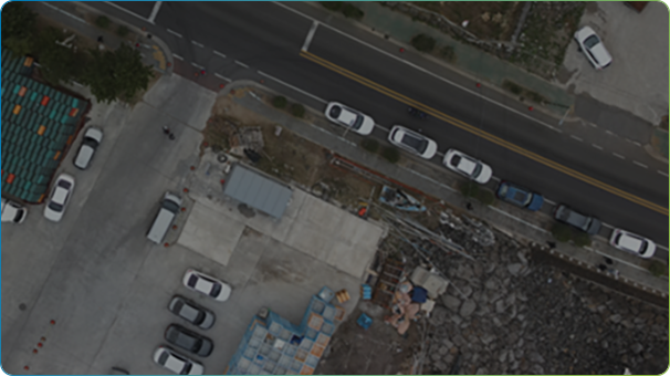
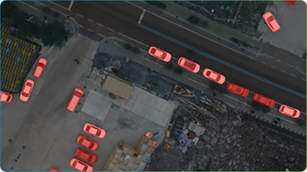
Geo_AI Detection & Removal of Object
Geo-AI enables automated object detection and removal, filtering out map-irrelevant items like people and cars from aerial and drone imagery. Our Geo-AI solutions transform labor-intensive, manual editing into a streamlined, automated process.
Orthophoto
Automatic Facility Detection
Geo_AI Object Segmentation
Geo-AI Object Segmentation is a technology that not only recognizes facilities as individual objects within aerial photography but also digitizes them into maps according to their actual shapes. Our proprietary Geo-AI segmentation technology leads innovation in the geospatial data construction process.
Airborne LiDAR
Multi-Class Detection
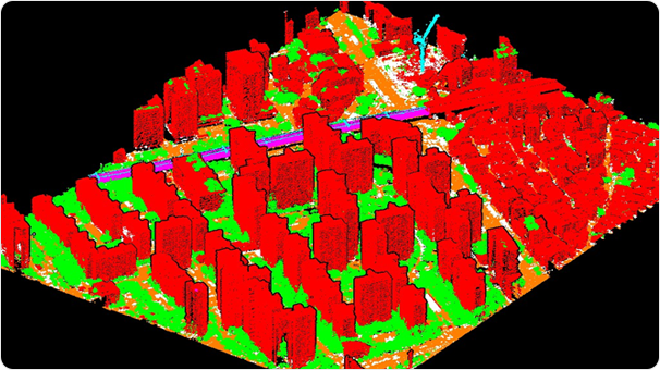
Geo-AI Airborne LiDAR Multiclass Classification
GeoAI-Classification Solution automatically identifies categories such as ground, buildings,
vegetation from large-scale point cloud data (LAS/LAZ) acquired by airborne LiDAR sensors,
and visualizes the results.
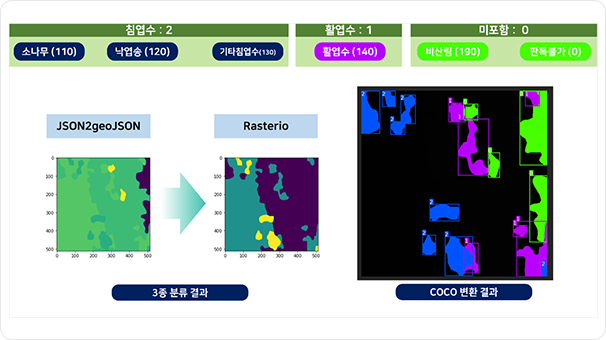
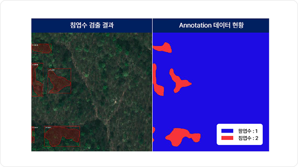
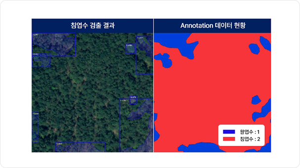
AI-based Forest Object Extraction
By learning from various geospatial data and satellite big data databases, we use AI to detect forest objects.By learning from various geospatial data and satellite big data databases, we use AI to detect forest objects.
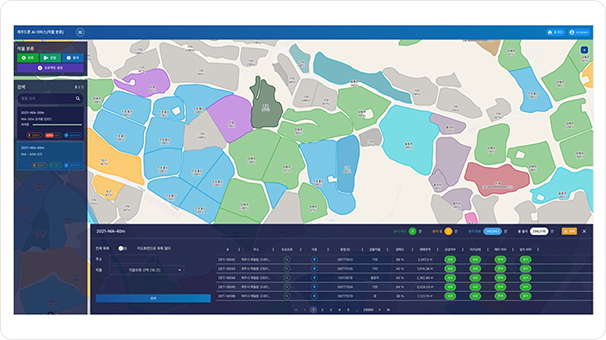
AI-based Crop Type Detection
AI-based Crop Yield Prediction
An AI trained on orthophotos automatically detects crop types
and predicts crop yields based on geospatial information.
The AI trained on forests automatically detects forest species and environmental changes to calculate carbon sequestration.
The AI trained on forests automatically detects forest species and environmental changes to calculate carbon sequestration.

Text Searching
Image Searching
Multimodal AI Search Solution Euler Search
-
Euler Search is a multimodal embedding-based search engine that delivers
comprehensive results by understanding various data formats -including text, video, audio,
and spatial data- and similarity-based searching encompassing related references.

Digital Twin Service with MapPrime Euler
As an agentic AI platform, Euler not only deliver prepared services individually but also can be
integrated with existing or newly developing information system, maximizing service value and
efficiency.